
Touring England of the 1600s: Focusing on the Fairbanks: The Family Lands in the Sowerby Area
Jonathan and Grace were listed as living in Warley, England, on their marriage registration of 1617 at Halifax St. John’s Church. The land of the Fairbank family in the area documented back to the 1500’s, occupied what is now called Sowerby Bridge. Both Jonathan and Grace Fairbanks and John and Mary Prescott are said to have emigrated from Sowerby.
Sowerby and Warley are townships in West Yorkshire in the northeastern part of England. They are also the name of towns within the townships. The townships lie sided by side, separated by the north turning Calder River, the southern part of Sowerby on the west and Warley on the east.. Both townships are important in the Fairbanks history.
Sowerby Bridge

A packhorse bridge in Sowerby area built in the 17th century. It was dismantled in 1859, John Bates Slide Collection held at Sowerby Bridge Public Library.

Sowerby Bridge as seen today.
To orient you to the area, we’ll start at the bridge from Halifax, a short distance northeast, that crosses the Rivers Calder and Ryburn confluence. The bridge that crosses into the Warley and Sowerby areas at this point is known as Sowerby Bridge or, sometimes, County Bridge. It is documented as Sowerby Bridge as early as 1314. Sowerby Bridge was likely a wooden structure early, but changed to a more stable structure of stone as seen above.
The town surrounding the bridge is now called Sowerby Bridge. It was carved out of the very large ancient parish of Halifax in 1869. It included parts of old Skircoat, Warley, Sowerby, and Norland.
The town of Sowerby, called Sowerby Town now, is documented as early as 1086 in the Domesday Book, the early history of England, and lies up a steep grade on a knoll.
Brigg Chapel

Sitting park commemorating Old Brigg Chapel. The park is approximately the size of the old chapel. Sowerby Bridge
Before you cross County or Sowerby Bridge going from Halifax to Sowerby on A58, there is a small park on your left. It commemorates a small church, Brigg Chapel. The chapel was only twenty-six yards by eight yards when it was built in 1526, just to the east side of Sowerby Bridge at the confluence of the Rivers Calder and Ryburn. The church was supported mainly by Warley and Norland, and to a smaller extent Skircoat. This bridge is very close to what is believed to be the Fairbank land of Briggbotham (meaning bridge bottom).
Because of its proximity to the Fairbank land and not requiring a steep climb to St. Peter’s Church in Sowerby Town, some of the Fairbank family may have attended this small chapel as a church of ease.
In 1632, shortly before the Fairbanks emigrated, Brigg Chapel was rebuilt and galleries were added to seat 426 parishioners. Later in 1821, due to flooding and to accommodate a growing population, the Christ Church was built on Wharf Road on the other side of the bridge. Brigg Chapel was torn down.
One of Jonathan’s relatives gave money to Curate Root, who officiated at the Brigg Chapel and later at St. Peter’s. Lower Brig Botham Farm was purchased by the Christ Church to subsidize the new Christ Church.
If you want to see the commemorative park where Brigg Chapel stood, parking is difficult. We exited the road to the east on the north side of the Sowerby Bridge and found temporary parking there.
Land of the Fairbank/s of Sowerby
The below is the abbreviated findings of the early land transactions of the Fairbank’s wills and the Rolls at the Court of the Manor of Wakefield published in the research of Ruth Fairbanks Joseph and James Swan Lamdberg’s in “Jonathan Fairbank of Dedham, Massachusetts, in the West Riding of Yorkshire” found in The New England Historical and Genealogical Register 166 (July 2012): 165-87. It has been abbreviated for ease of reading.
1498 William Fairbanks (1455-1518) was a Warley tenant of Wynlufroide until 1498
1506-07 William Fairbank gave Briggbotham, seventeen acres and Pighill Croft to his son John.
1526 (Sowerby) John Fairbanke (1480-1551) gave Brigbotham and such to the use of his son Gilbert.
1551 (Sowerby) “John Fairbanke, the father, and Gilbert Fairbanke, the son and heir of John,...surrendered unto the lord's hands one messuage, one garden and half of one barn and one croft called Lathecroft, two closes of land and meadow called Overholme and Netherholme and a wood called Le Sprynge to George Fairbank, son of Gilbert.“ 1551 [Sowerby] Gilbert Fairbanke (1505-1577/78) ...surrendered unto the lord's hands all and every one of those messuages, lands, meadows, closes, tenements and rents and customs with appurtenances in Sowerby estimated at eighteen and a half acres: to the use of George Fairbank, son and heir of Gilbert.
1583 (Sowerby) George Fairbank (1630-1610) surrendered the bulk of his property to his son George Jr, (George of Sowerby Bridge). Two of the sons of George Sr. were George Jr. (1562-1610), and John Fairbank (c.1593-1625). George Jr. and John being brothers. Jonathan, the emigrant’s, father was John Fairbank and George Jr., his uncle.
1619/20 (Sowerby) The land in Sowerby was passed down from George Jr. to his wife Hester and son John. In 1635, the land was given to Jonathan, the vicar, and George Fairbanks, the sons of George Jr. and Hester. That included Briggbotham.
In 1687, Sept 30, according to the Wakefield Court Rolls, Jonathan Fairbank, the vicar, son of George Jr. of Sowerby inherited “all the messuage called Briggbothom and an orchard, a garden , a croft called Tenter Croft and 6 whole closes called les Holmes, 2 other closes called les Banks, and all structures built thereon with appurtenances in the graveship of Sowerby, also two cottages adjacent to messuages, and a messuage adjacent to Brigbothom on the west, and a garden and two closes.”
The land in Sowerby was in the Fairbank line from the 1500s to the late 1700s, perhaps longer. John Fairbank, son of George Sr., nor Jonathan Fairbanks, the emigrant, owned any of this land but likely lived on parts of it during their life.
John Fairbank (1560-1625) Land in Thornton-in-Craven
John Fairbank (c1560-1625), the emigrant’s father, and the brother of George Jr. of Sowerby, was probably born and lived on the land of the Fairbank family in Sowerby at various times during his life. John Fairbank, the emigrant’s father, was married three times.
John’s first wife’s identity is unsure. Their first child was born in Sowerby in 1583. All other children were born while they were in Skircote including the last son of 1590 who died in about a year. John’s first wife is believed to have died between the birth of the last son, childbirth being the major cause of death of women at that time, and 1593 when John remarried.
In 1593, John married Isabella Staincliffe at Halifax St. John’s Church. They resided in Skircoat. It is believed Susan and Jonathan, the emigrant, were born to this marriage. Susan was baptized in Halifax. Of all John’s children, only Jonathan’s baptismal records have not been found. Isabella died in Skircoat in 1597.
John and his third wife, Ellen Parker, married in 1598. Their first child was born in Skircoat in 1599. Three subsequent children were born in Sowerby between in 1600 and 1603. By 1605 , they were in Carleton-in Craven or Thornton-in-Craven areas where they remained until John died in 1625.
The sons of John Fairbank, father of the emigrant Jonathan, left the land he amassed in the Thornton-in- Craven area to his sons, except Jonathan. I will only refer to the sons that were named in his will and who will appear in the book. By his first wife, son John was primogeniture (first son who would most likely inherit the father’s land) and George inherited land there. By his second marriage to Isabell (Staincliffe) Fairbank, there is believed to be only one son, Jonathan, the emigrant. He inherited no land even though he remained in England eight to ten years after the 1625 death of his father. By the third wife, Ellen (Parker) Fairbank, Jeremy and Michael received land as indicated in John Fairbank’s will.
Jonathan Fairbanks (btw 1594 & 1597-1668), the emigrant
Jonathan Fairbanks, the emigrant, was likely born in Skircote. He is said to be from Warley on his marriage registration to Grace (Smith) Fairbanks in 1617. Their first child, John, was born in Sowerby in 1618. Two children were born in Shelf. Then Jonas was born in Sowerby in 1624. Susan is believed to be born in Thornton-in-Craven in 1627, though the records are damaged. There is no history of where Jonathan was born about 1629.
Jonathan Fairbanks, the emigrant, and John Prescott are said to have immigrated to Massachusetts Bay Colony from Sowerby, West Yorkshire, England, in the early 1600s.
So there were many opportunities for John, the father, or Jonathan, the emigrant, to live on the land owned by the Fairbank family. It was common for family members to live near one another and even change houses as changes arose in the needs of each family.

Facimile of 1804 map of Sowerby from West Yorkshire Archive Service, Halifax. Briggbotham, 18 1/2 acres, starts at Sowerby side of Sowerby Bridge. Old Haugh End Lane courses past Old Haugh End cottage and the Gate house. This road becomes Brockwell Lane. The school short cut was found just west of the Gatehouse.
Briggbotham
Bridge Bottom
Per Ruth Fairbank Joseph’s research of the Wakefield Manor Rolls held by the Yorkshire Archeological Society, the record documented as MD225/1/345 1619 Court of 7th April 18 James I [1620] [Entry 87 Sowerby:] specifically indicates that two messuages (buildings with outbuildings and land assigned to its use) and 18 acres of land owned by George Fairbanck lay next to Sowerby Bridge.
On the west side of the Sowerby Bridge is bottom land along the River Ryburn. This land is level as compared to the steep knoll where the town of Sowerby is built. The bottom land was not considered the most desirable for farming early, nor was the steep stony face of the Pennines. However, for wool processing, being close to the rivers had its advantages. Many of the Fairbank family were in the cloth trade. John, the father of the emigrant, was a yeoman, owning land. He established himself in Thornton-in- Craven where wool trade was still primary, but farming was also functional.
The Fairbank family owned Briggbotham from the 15th century. Brigg as we see for Brigg Chapel means bridge. Botham means bottom, dale, or valley floor. The Fairbank family owned eighteen and one-half acres called Briggbotham. We don’t know if that included the lands they owned by other names. Briggbotham is not named on the 1804 and 1849 maps of Sowerby that were viewed at West Yorkshire Archival Services (WYAS), on the bottom floor of the Halifax Library outside Piece Hall. But there are several clues regarding the possible location of this land.
The Christ Church bought acreage of Lower Brig Bottom Farm in 1724. They bought other land for the same purpose. This land was used to help subsidize the building or workings of the church. The Christ Church did not use that land to build upon. The address of the Christ Church is Wharf St, Sowerby Bridge, Halifax HX6 2LW,
There is a Fairbanks postal code, HX6 2AB, and a housing development called Fairbank on Fairbank Road just off of Wharf Road.
Fairbank Textile Ltd., a functioning industry of needled felt and textile fiber blending for cushioning carpets and cars, bedding, upholstery and fabrics is located nearby. Its address is West End Mill, West Street, Sowerby Bridge, West Yorkshire, HX6 3AN in the Ryburn bottoms.
The church, postal code with housing development, and textile factory are within about 1/2 mile of each other starting from the bridge reaching west along the Ryburn bottoms. Though the names do not have to be derived from the previous owners of the land, that is often found to be true.
Pighill Croft
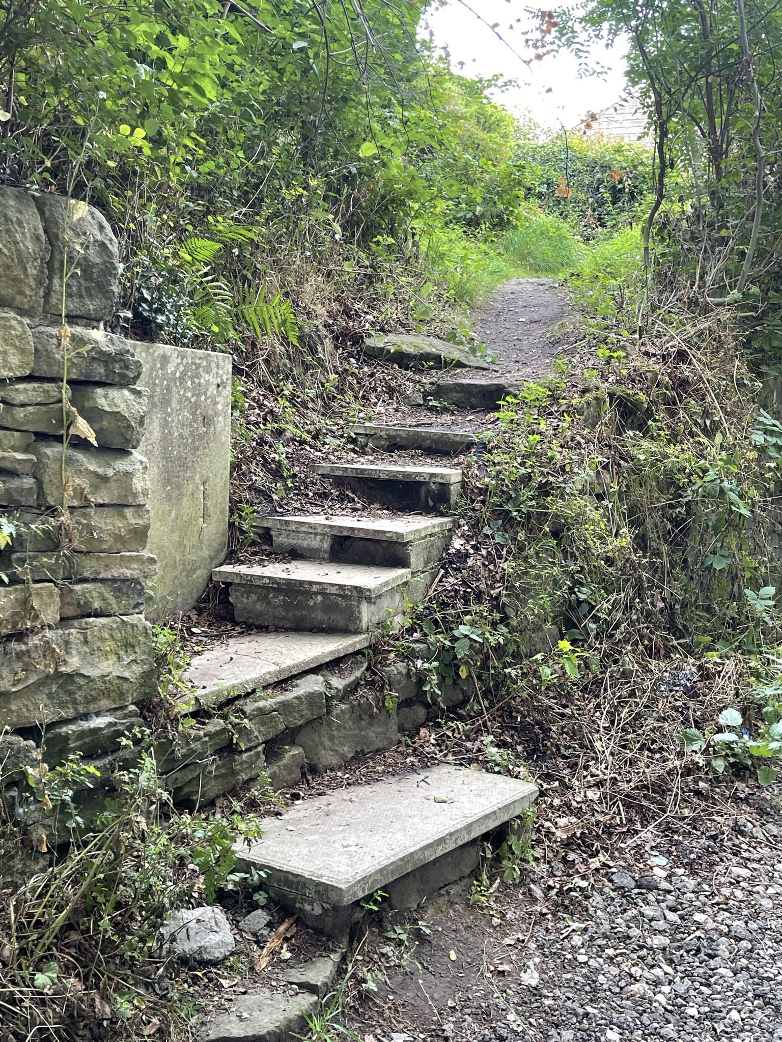
Steps from a well-beaten path between houses toward the school on St. Peter’s Avenue. The path went from the steps at Old Haugh End Lane between houses to Breck Lea then up the road to St. Peter’s Avenue, We thought surely this was “Piggy Lane,” the children’s short cut.
Another property owned by the Fairbank of Sowerby was called Pighill Croft. It was described as one acre of land. A croft indicated there was a house with grounds around it to support those who lived in the house with possibly a garden, chicken coops, and pig’s sty. The house had rights to common land with other crofts and was probably rented. Sowerby Street believed to follow an ancient Roman road. It was also called Phygill Street (although street was not often used early). This road is the backbone of Sowerby. The road was the pack horse trail from Lancashire and Cheshire to Leeds and York. Pack horse trains carrying wool and wool products followed the higher elevations. All the water runs to the River Calder on the east and to the Ryburn to the west. The Sowerby New Road travels to an intersection of St. Peter’s Avenue which makes up the St. Peter’s Church yard.
Sowerby was once densely wooded and had varied wildlife hunted by the nobility. Perhaps this was once an area that wild boar were hunted. The rocky hillsides were not suitable for raising livestock, such as cattle, or growing crops other than gardens to support the homes. Pigs, a foraging animal, may have been raised by each home for personal use in this area.
The children that attend the school on St. Peter’s Avenue near the Brockwell housing development still call a short cut from Old Haugh End Lane to the school, Piggy Lane. One English follower says Piggy Lane is Brockwell Lane leading to Brockwell Estate. He says there was a hog farm in that area in the 1950/60s. However, we walked a beaten path opening between houses on Breck Lea through a grassy field that ended in steps at Old Haugh End Land that we felt could be “Piggy Lane.”
Because of the name of the old lane Phygill and the school children’s Piggy Lane path and their close proximity to other land owned by the Fairbank of Sowerby, it is quite possible that one acre of land in the area between Sowerby New Road and Old Haugh End could have been owned by the Sowerby Fairbank. Since Jonathan and Grace, relatives of the Fairbank of Sowerby are said to emigrate from Sowerby, It is possible they lived in one of the rented lands of the Fairbanks family while in England.
Brockwell

Sign along St. Peter’s Avenue to Higher Brockwell Road

Steep downhill street from
St. Peter’s Avenue takes you down to the land of Brockwell.

Believed to be the old gate-house for Brockwell or Old Haugh End or for both. It is found halfway between the two on Old Haugh End Road
Brockwell
Le Brockwell and 8 acres of land are mentioned in the Wakefield Court Rolls (MD 225145 1619 Court 7 April (18 James I 1620) Entry #89). The postal code for this area today is HX6 1BP. It has become a housing development. There is a gatehouse situated between Brockwell and Old Haugh End Cottage, which will be addressed below. A gatehouse was the lodge of the gatekeeper near the entrance of a large dwelling and land. The gatekeeper was to stop and refuse entrance to those who didn’t have official business on the land. The staff at West Yorkshire Archive Services suggested that this gatehouse could have acted as protection for both Brockwell and Old Haugh End.
Clough House
Clough can mean ravine, glen, or gorge. In 1634, Dickson surrender 3 acres, 1 rod and building and buildings called Clough House to the use of George Jr. of Sowerby that Jonathan and George, probably his sons, now occupied. Noting the date, this was the year Jonathan, known as the vicar, graduated from college. It is after or near the time Jonathan, the emigrant, left for the Massachusetts Bay Colony. Clough House is now found at HX6 1NJ and is considered in Boulder Clough. This is not believed to be the original house but the location of the land at that time.
Other Fairbank land in Warley and Sowerby
There were other Fairbank land documented, see Ruth Fairbanks Joseph’s work, but has not been located at this time. In Warley, William Fairbank (1455-1518) was a Warley tenant at Wynlufroide until 1498. There is a street location with a similar name.
As parcels of land were often named for an outstanding feature of the area, the names are often used in various villages. Several of the lands named in the Fairbanks’ wills carry such names.
Laithcroft - Laith means shed or barn. Croft - see Pighill Croft for definition.
Tenter Croft - Tenters were the large frames that people working with the wool stretched long lengths of fabrics on to dry.
Over and Underholmes - or le Holmes or le Banks. Over and under means the land above or below. It may indicate direction or elevation. Holmes means a small island in a river or near a mainland, a piece of land surrounded by swampy land, or a piece of flat ground by a river that is submerged at times of flood. This seems as if it could be near or a part of the bottom land called Briggbotham.
Le Sprynge - was described as a wooded area. Sprynge means spring, so perhaps a spring arose from that area. Most of Sowerby was covered by woods early.
Old Haugh End Cottage
Triangle, West Yorkshire
Triangle is a small triangular piece of land formed by an old road which parts from the newer A58 toll road to Rochdale. It didn’t get the name Triangle until the 19th century. Old Haugh End Lane was a packhorse route from Chester to York. Old Haugh End as land and buildings was know as the Platts at that time.
Old Hauge End Cottage is the oldest building on the property and one of the oldest buildings in the area. This was not land of the Fairbank family, however, it is significant to both Fairbanks and the Prescotts who emigrated from Sowerby. In the time of the Fairbanks and Prescott emigrants, this land was known as Platts. It lies up from the Ryburn Valley on the north side of the river .2 miles from Brockwell Lane, which was owned by the Fairbank family at that time.
Mary Gawkroger Platts, was a relative of Grace (Smith) Fairbanks, she was also possibly a relative of the Fairbanks. Mary Gawkroger Platts married John Prescott. Platts is a place name, not a sir name. There were many Gawkrogers in the area, enough that it was difficult to make distinguish between the people with common given names. The Gawkrogers of the Platts area took the alias to their name to make the distinction for their family. The land is of interest because it locates the proximity between the area called the “Platts” and Brockwell land of the Fairbank family. On the 1804 and 1849 maps at WYAS, there are two more Gawkroger properties north of Old Haugh Cottage near White Windows.
Old Haugh End complex is made up of the Old Haugh End Cottage, a manor house, a servant’s building, a kitchen, a carriage house and a wool factory stand along with a barn and gardens. The Old Haugh End cottage built in the 1500s is one of the oldest buildings in the area. The other structures were built in the 1700s. Even the Old Haugh End Cottage was added onto making several cottages.
The Old Haugh End Cottage along with a sizable parcel of land stretching north of it in the 1500s. was owned by a clothier, John Gawkroger. He rented out the Cottage, but lived on the north side of his property at Haslehirst near the more recent White Windows. John died in 1569 leaving his estate to his wife and one of his sons. They continued to receive income from the estate.
It is unclear when the ownership of the Gawkroger’s (Platts) Cottage and land changed hands, but the Old Haugh End Cottage has a distinguished history of its own in the West Yorkshire area.
In 1630, a clothier rented the Cottage. While living there, they gave birth to a son, John Tillotson. This would have been at least three years before the Fairbanks emigrated and eight to ten years before the Prescotts emigrated. This son was highly educated and became the Chaplin to King Charles II and Archbishop of Canterbury under King William and Queen Mary from 1691-1694.
On the Old Haugh End Cottage there is a blue plaque that commemorates this as the birthplace of John Tillotson. Inside the house, a small front room was decorated in commemoration of the birth of the Archbishop. The room contains fine wood paneling, stained glass windows, a carved sideboard, murals, and carvings. It has a mantel that has the date 1630 and the initials I and T on it ( I was used for J at that time). A near life-sized statue and picture are displayed at the St. Peter’s Church in Sowerby Town.
Old Haugh End is at HX6 3BJ and is only .4 miles west of the Fairbank Textile factory mentioned above.

John Gawkroger, alias Platts, owned land up from the Ryburn River Valley near the old packhorse road from Chester to York. Mary Gawkroger Platts would have lived in this area.

The Old Haugh End Cottage is one of the oldest houses in Calderdale.

The house was frequently leased. In 1630 John Tillotson was born in the house. In 1691 he became Archbishop of Canterbury. Commorative room.
Understanding the lands of our forefathers gives up a better glimpse of their life in the past. Although the land of Sowerby was in the family for centuries, some of the family, especially Jonathan Fairbanks, the emigrant, lived in several locations while in England. After settling in Dedham, neither he nor most of his children left Dedham, Massachusetts. We will explore briefly the the locations Jonathan moved his family in England in the next blog. In a later blog we will examine the primary land and buildings of his father, John Fairbank, in Thoronton-in-Craven, a location Jonathan and his family lived for at least a short time.
Up Next
Other things to see in Sowerby, Warley, and Surrounding Area


